5 Stunning Hikes Along Lake Tahoe's West Shore
If you crave breathtaking scenery, peaceful serenity, and a sense of awe-inspiring adventure, Lake Tahoe's west shore is the place for you. The trails in this region offer a diverse range of landscapes, from towering pine forests to rugged mountain ridges. As you hike along the west shore, you'll witness the crystal-clear waters of Lake Tahoe, explore hidden coves, and discover pristine alpine meadows.
Whether you're an avid hiker or a casual nature enthusiast, the west shore's trails cater to all skill levels, making it an accessible and rewarding destination for everyone.
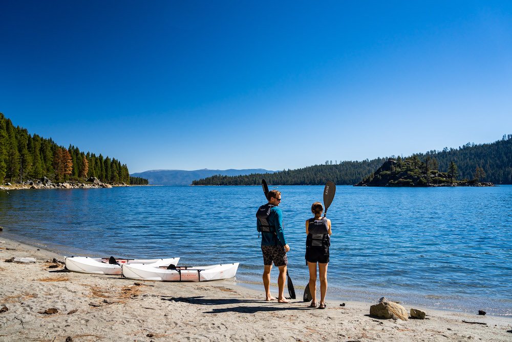
Make sure to sit and enjoy the alpine lake views while you hike along the West Shore of Lake Tahoe. Photo by Dalton Johnson
Pros
Breathtaking Scenery: The west shore of Lake Tahoe is known for its stunning panoramic views of the crystal-clear lake and the surrounding Sierra Nevada mountains. The scenery alone makes the hike worth it.
Varied Trail Options: There are numerous hiking trails to choose from, catering to hikers of all skill levels. Whether you're a beginner or an experienced hiker, you can find a trail that suits your preferences.
Opportunities for Water Activities: Hiking along the west shore also provides easy access to the lake, where you can enjoy water activities like swimming, kayaking, or paddleboarding after your hike.
Wildlife and Flora: The area is abundant in diverse wildlife and flora, offering opportunities to observe birds, small animals, and various plant species along the trails.
Seasonal Beauty: The changing seasons bring unique beauty to the region. From lush greenery in the spring and summer to vibrant fall colors, each season offers a different and stunning landscape.
Photography Opportunities: With such magnificent landscapes and scenic vistas, the west shore of Lake Tahoe provides ample photo opportunities for photography enthusiasts.
Proximity to Amenities: The west shore is relatively close to several towns and resorts, providing access to restaurants, accommodations, and other amenities to enhance your hiking experience.
Cons
Crowds: Due to its popularity, hiking trails along Lake Tahoe's west shore can get crowded, especially during peak seasons and weekends. If you prefer solitude, consider hiking on weekdays or exploring lesser-known trails.
Parking Challenges: Limited parking spaces at popular trailheads can be a challenge, particularly during peak times. Arriving early or utilizing shuttle services can help mitigate this issue.
Trail Conditions: Depending on the time of year, some trails may be affected by snow, mud, or fallen debris. Always check trail conditions before heading out and be prepared for changing weather.
Bugs and Wildlife Encounters: During certain seasons, you may encounter bugs or wildlife on the trails. It's essential to be aware of your surroundings and take precautions to avoid any negative encounters.
Trail Maintenance: With heavy foot traffic, some trails may experience wear and tear, leading to uneven paths or deteriorated sections. Always watch your step and be cautious in potentially hazardous areas.
Rubicon Trail:
The Rubicon Trail is an iconic shoreline trail that winds 15 miles along Lake Tahoe's west shore, offering stunning views at every turn. With options for both short and long hikes, you can explore hidden beaches, admire granite cliffs, and take a dip in the inviting waters of the lake.
Trailhead: The Rubicon Trail can be accessed from various points along the west shore of Lake Tahoe, including D.L. Bliss State Park and Emerald Bay State Park.
Distance: The full Rubicon Trail is approximately 15 miles long as a one-way hike, but shorter sections can be hiked as well.
Elevation Gain: The elevation gain can vary depending on the section of the trail you choose, but it's generally moderate.
Time to Hike: The full 15-mile hike could take around 6 to 8 hours to complete.
What You See: The Rubicon Trail offers stunning views of Lake Tahoe's crystal-clear waters, rocky cliffs, and dense forests.
Eagle Falls Trail:
Beginning at Emerald Bay, the Eagle Falls trail takes you on a journey through a picturesque forest, leading you to the breathtaking Eagle Falls. Continue your adventure to Eagle Lake, a tranquil alpine oasis that rewards hikers with mesmerizing views of the surrounding peaks.
Trailhead: The Eagle Falls Trailhead is located near Emerald Bay State Park on the southwest shore of Lake Tahoe.
Distance: The trail is approximately 2.5 miles round trip.
Elevation Gain: It has an elevation gain of around 600 feet.
Time to Hike: The hike usually takes around 1.5 to 2 hours to complete.
What You See: Eagle Falls Trail takes you to Eagle Lake, offering beautiful views of the waterfall and Lake Tahoe from various vantage points.
Paige Meadows Loop:
Perfect for those seeking a peaceful escape, the Paige Meadows loop trail meanders through expansive meadows dotted with wildflowers. As you wander through the serene landscape, soak in panoramic views of Lake Tahoe and the surrounding mountains.
Trailhead: The Paige Meadows Loop can be accessed from several points, with the main trailhead located near the town of Tahoe City.
Distance: The loop is approximately 6 miles long.
Elevation Gain: It has a relatively gentle elevation gain, making it suitable for most hikers.
Time to Hike: The hike usually takes around 2.5 to 3.5 hours, depending on how much time you spend enjoying the meadows.
What You See: Paige Meadows is known for its picturesque alpine meadows, wildflowers, and beautiful views of the surrounding mountains.
Mount Tallac Trail:
For those seeking a more challenging hike, the Mount Tallac Trail is a must. Starting just outside of South Lake Tahoe at 6,500 feet, ascend to the summit of Mount Tallac, standing at 9,735 feet, and be rewarded with awe-inspiring panoramic views of the entire Lake Tahoe basin.
Trailhead: The Mount Tallac Trailhead is located near the southwestern shore of Lake Tahoe, off Highway 89.
Distance: The round-trip hike to the summit and back is approximately 10 miles.
Elevation Gain: The trail gains around 3,200 feet in elevation.
Time to Hike: The hike can take around 6 to 8 hours to complete.
What You See: The Mount Tallac Trail offers breathtaking panoramic views of Lake Tahoe, Desolation Wilderness, and the surrounding Sierra Nevada mountains.
Ellis Peak Trail:
Offering a less crowded experience, the Ellis Peak Trail rewards hikers with sweeping views of the lake and surrounding peaks. This moderate to challenging trail takes you through fragrant forests and opens up to stunning vistas that make the effort well worth it.
Trailhead: The Ellis Peak Trailhead is usually accessed from Barker Pass, located on the western shore of Lake Tahoe.
Distance: The round-trip hike is around 6 to 7 miles long.
Elevation Gain: It has an elevation gain of approximately 1,500 to 1,800 feet.
Time to Hike: The hike typically takes around 3 to 4 hours to complete.
What You See: From the summit of Ellis Peak, hikers can enjoy stunning vistas of Lake Tahoe and the surrounding mountain ranges.
Hiking to watch the sunrise at Eagle Falls along the West Shore of Lake Tahoe. Photo by Dalton Johnson
Hiking along Lake Tahoe's west shore promises an unforgettable experience for nature enthusiasts and adventurers alike. With its awe-inspiring scenery, diverse trails, and proximity to the stunning lake, this destination offers a perfect blend of outdoor exploration and relaxation. While managing crowds and staying prepared for changing weather are essential, the rewards of witnessing the breathtaking beauty of Lake Tahoe and its surrounding landscapes make every step along the west shore well worth the journey. So, lace up your hiking boots, immerse yourself in the natural wonders, and create lasting memories in this picturesque haven of wilderness and tranquility.


